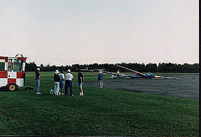
Normally first flights
are half hour flights with the instructor doing most of the flying. Because
I had 210 hours in gliders by this time the instructor never touched a
thing during our entire start up to shut down, 1.7 hours. Most of the flight
was in the practice area and then we headed back to the runway. When I
turned onto final I said, "My God, we'll never get down from here". The
instructor said that all glider pilots said that. Most gliders have the
brake control at the end of the spoiler pull. You haul back on the lever
and after touching down use a bit of pressure and start to brake. I rounded
out and touched down on the pavement and immediately heard a terrible screeching
noise followed by a second one. The first was because I had both feet tightly
on the rudder pedals, including the top portions which are the brakes.
The second was the instructor screaming at me to get off the brakes. I
did and we went around again. From that time on I always made sure that
my heels were touching the floor until after touching down.
 |
 |
 |
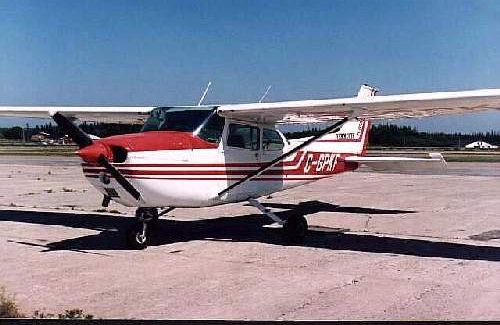
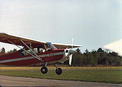
The center picture is myself in the cockpit of the AA5. It can be seen
how low the fuselage is to the ground and how close the prop tip will go.
In the right picture I am standing on the wing of the AA5. One thing I
liked about this particular aircraft was the ID, GDR, which is a short
form for glider.
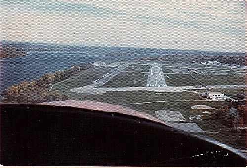
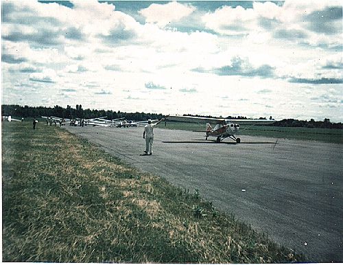
On landing the tow pilot has to watch for gliders in the circuit (their's is tighter than the tow plane's) and if on final he spotted a glider anywhere in the circuit, or was warned by radio, he would then do a wide 360 degree turn away from the circuit. Sometimes he would just line up again and another glider would start his circuit, so another 360.
 |
 |
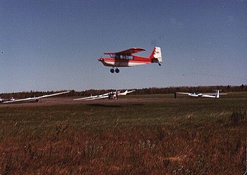 |
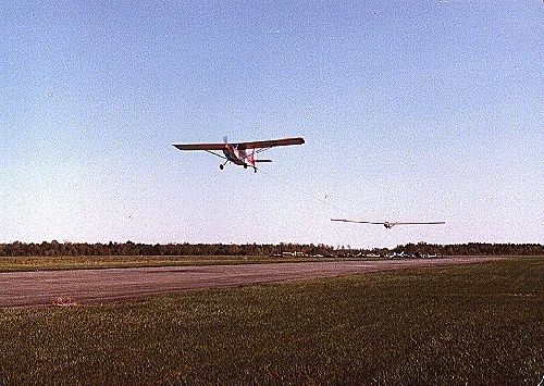
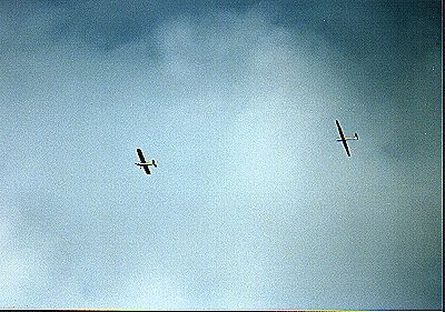
The second picture show a tow plane and glider as they start to climb together. The flight line can be seen in the background with a number of aircraft and the field manager, helpers and pilots. The third picture shows the tow plane landing. He has just released the rope which can be seen over the glider at the right middle of the shot. The rope end nearest to the tow plane has a steel ring that was attached to the plane.
All take offs are from the ashphalt runway and the landings on the grass strip beside it. The paved runway is much better for take offs while the grass is easier on the tires, glider skids and wing tips.
| Sunset at GGC | Old Tow Plane Landing | New Tow Plane Landing |
 |
 |
 |
| Tow From The Ground | Engine Problem | Engine Stopped? |
 |
 |
 |
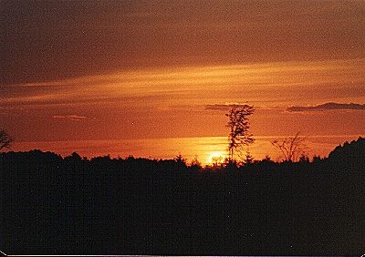
Sunset at GGC
Always like sunsets. The one above was taken at the end of
a flying day at the Gatineau Gliding club.
Old Tow Plane Landing
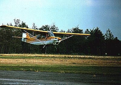
One of the tow planes that we used when I first joined GGC, a Champion.
Our second tug at that time was a Citabria.
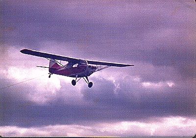
New Tow Plane Landing Eventually we got two new Citabrias and sold the first two planes. One of the new ones was yellow and the other red.
Tow From The Ground People can get sore necks watching tow planes pulling gliders while they are standing on the ground. You can't keep your eyes off the sky while standing at a gliding club.
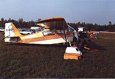
Engine Problem QIL caused us quite a few problems with it's engine. It spent quite a bit of time off the line with members having a go at it, and more time at a shop away from home. Eventually we had to replace the engine.
Engine Stopped? The last picture is of the Champion just before touch down. It was throttled back and with a fast camera setting it appears as if the prop was stopped, but it wasn't, just at idle..
| Fishing Docks | Another Fishing Dock | Sandford Area |
 |
 |
 |
| Yet More of Them | Yarmouth Lighthouse | Working Area |
 |
 |
 |
| Our House | Smuggler's Cove | Tin Mine Buildings |
 |
 |
 |
| Tin Mine Pattern | Lobster Rock Wharf | Town of Yarmouth |
 |
 |
 |
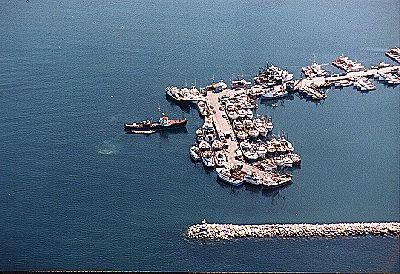
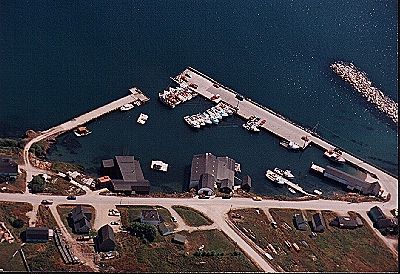
Fishing Docks Lobster season for our area is from the end of November to the end of May each year. This picture shows docks behind a huge man built rock breakwater. The smaller boats are for lobsters. the larger ones are for ground fish and scallopers. I am not sure what the really large one in this picture is.
Another Fishing Dock This scene is a little further up the coast. The village up the hill in the background is Port Maitland. To the left of the main wharf is a beautiful beach with a parking lot behind it and an area with picnic tables and stone BBQ's. At low tide you can walk out past the bend in the wharf. One time Marge and I were about 100 feet from the wharf with our poodle Tara II. The tide was coming in as we sat with our backs to the water, on our folding chairs. All of a sudden a big wave came and came half way up the chairs and tossed Tara up to the sand bank. It was startling but something to laugh at.
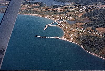
Sandford Area Sandford
is about ten miles from Yarmouth. It is a unique set up with it's outer
breakwater and wharfs, a narrow entrance way to a square area used for
unloading and docking. Then there is an inner lagoon that is emptied at
low tide. Great for boat repairs and painting.
Yet More of Them This
is a nice view. I don't think that anyone will ever see two fishing wharfs
that look alike. I guess if a fellow took the left wharf in error he would
jump over to the row of boats, climb across them and jump onto the correct
wharf.
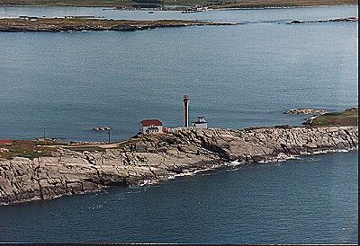
Yarmouth Lighthouse This lighthouse was built in 1967. The old one then was torn down. On the other side of the lighthouse is the entrance to Yarmouth Harbour. The water below is called False Harbour because over the years many ships and boats have entered it in error, thinking that they were coming into the Yarmouth Harbour.
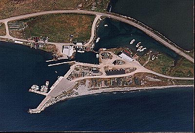
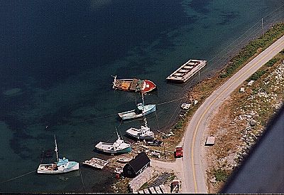
Working Area From Yarmouth there is a narrow strip of land that leads to a bridge to cross over to an island. At the other end of the island is the causeway shown here that leads to the island on which the lighthouse is situated, at the other end. In the off season a number of boats are located here where repairs and painting is done. The red boat sits on it's side when the tide goes out, as well as when it comes in. The thing that looks like a huge raft is called a 'car'. I don't know why but it is used to store lobsters in. This causeway cuts False Harbour off from the Yarmouth Harbour.
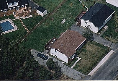
Our House I took a friend up for a flight and he took this picture of our house as we flew over it. It is the one in the upper right corner. In the backyard is a rose trellis that was blown over in a big wind storm.
Smuggler's Cove About twenty miles up the coast is the village of Meteghan. It starts a little on this side of the cove shown below. Not the island on the far side of the cove. The inlet is called Smuggler's Cove and the cave, Smuggler's Cave. During prohibition huge amounts of whiskey were stored in the cave until it was shipped to the States. At high tide the entrance to the cave was under water.
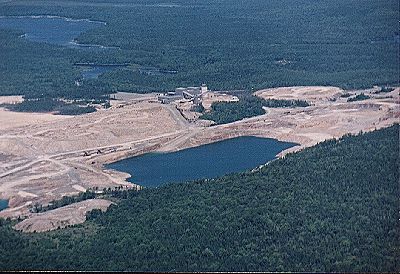
Tin Mine Buildings The tin mine was an open faced one. The buildings to the right of the center are quite large. The area where the surface was removed was very big, and very white. It can be seen from our airport by the time you reach 1000 feet. The water is where water used in the mine operation is placed after use. It is very contaminated.
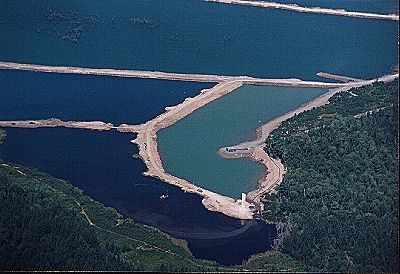
Tin Mine Pattern More of the contaminated waters. I thought that this was a nice design. I think that the different colors are caused by different comtaminants.
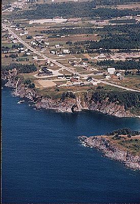
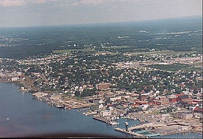
Lobster Rock Wharf Coming home. This wharf is right in the town of Yarmouth. To the right of it is the jetty where the ferries coming into Yarmouth dock. The elbow shown is where the vehicles leave the ferry and approach the customs area at the bottom of the white lines.
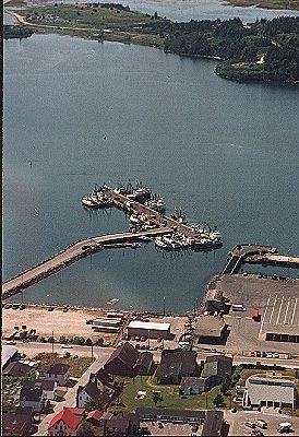
Town of Yarmouth And this is the northern half of Yarmouth. At the bottom of the picture is the ferry jetty and beyond it is another fishing boat area and public wharf.
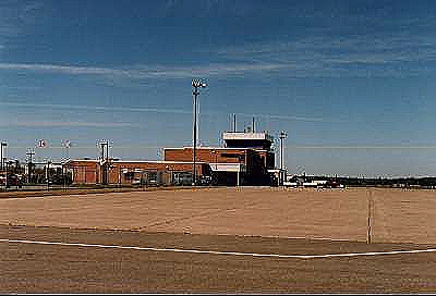
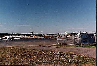
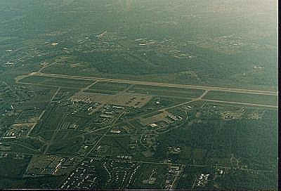
| Yarmouth Airport | Hole in Fog | Bangor Airport |
 |
 |
 |
| Mount Washington | I'm co-pilot | Berlin - Not Germany |
 |
 |
 |
| White Face Mountain | Back to GGC | Rockcliffe Flying Club |
 |
 |
 |
| Lake Placid Airport | Bangor Airport | Moncton, NB |
 |
 |
 |
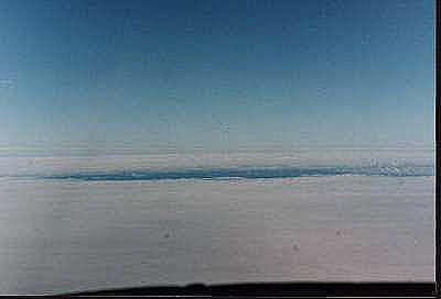
Hole in Fog I had never flown across the Bay of Funday before so I started the flight. We took off and climbed to 4000' passing just south of Brier Island of the Digby Neck. From that point there was a complete blanket of fog below us, right down to the water. So much for the beautiful view that I was expecting. As we approached Grand Manan Island (a Canadian Island off the coast near the USA and Canadian borders) we saw a large blue hole in the fog ahead. As we passed over it we could see about a third of the island.
It was our intent to land at Eastport on a small American island. Because of the fog we could not and Claude called in a change of plans, to land at St. Stephens, NB. The fog was in past that area so the plans were changed again to head for Bangor, Maine.
Bangor Airport As we neared Bangor Claude called in our intention to make a right hand ciruit instead of the usual left, because of our direction and the traffic in the area. It was approved and we were given a position behind two cargo 737's and in front of a third one in the pattern. By the time we got into the circuit the third 737 was in a position where we were told to follow him. We did so and I made sure that we stayed in the air beyond his touch down point to avoid his vortices.
I had got caught behind a Dash 8 while landing at Rockcliffe airport while I was about 300' above ground. With no feeling of movement I was suddenly turned to a point where my wing tips were up and down. It took both hands on the yoke to get it back to level flight.
In the picture one of the cargo planes is seen having just landed and still on the runway. They were all painted black.
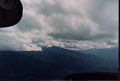
Mount Washington When we cleared customs in Bangor we had lunch and then Claude took the second leg. Later we passed Mount Washington with her peak in the clouds. We were flying up a valley of mountains, most of them with the peaks hidden.
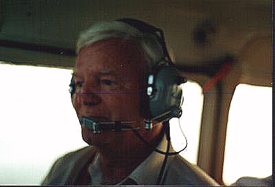
Mount Washington During this leg I was co-pilot and read the map. I always found map reading quite easy and in that area if was very easy.
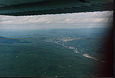
Berlin - Not Germany A little later we approached Berlin, NH. As I looked out the right side and towards the rear I was able to get a good picture of it. Berlin is in a valley that stretches off the the right of the one that we were following.
In Vermont there is a place called Sugarbush where GGC pilots used to go in the Fall. On good days you could get up to well over 20,000' because of the mountain winds. I only went there one year and there wasn't much wind so no big lift. On the first flight in the area a second pilot went in the back seat as advisor, in the K-13. We did get thermal lift and I was able to get above the mountain top which was not too high. I had passed my movie camera to the glider pilot with me to get some shots during the flight.
There is a road that goes from an area near the top and twists down into the valley. On one bend there were a number of vehicles, cars, trucks and RV's, with the people standing in a group beside the road. I told my buddy that I was going to give them a thrill and dive down towards them at a 45 degree angle to the mountain. The dive gave me extra speed and I flew to within a hundred feet of the crowd, levelled off and turned out towards the valley. Within seconds I was at 2000'. I did not climb, the mountain fell away. I asked my buddy if he got a good shot, and he said no, he had forgotten to take a one.
As we passed over the area on this day, Claude heard a tow pilot and looked down and saw him with a glider behind. It excited me to see them.
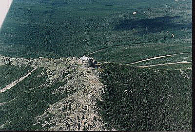
White Face Mountain We crossed Vermont into upper New York State. Then Claude followed the Keene Valley until he reached White Face Mountain. I got a shot as Claude circled. At the peak is a building with an eatery and gift shops. On our side is a tower with a rock near it, which I believe is the spot that has the sign showing the highest spot of the mountain. The road to get up there is seen in the background.
From there Claude flew to Massena, NY and landed to refuel. The gas is so much cheaper in the States than in Canada. I took the next leg, landing in Cornwall, Ont. to clear customs. From there we flew to Pendleton Airport, home of the Gatineau Gliding Club. It was a Friday in the evening and no one was there of course. We walked about a bit and then as I started to take off a car approached, but we were on our way.
Rockcliffe Flying Club We went to Rockcliffe and got a tie down area for the week-end. The next day I flew to GGC and we spent the day there. Claude flew us back to Rockcliffe. As we we approached the airport we heard radio talk about Hot Air Balloons in the area. Suddenly ahead we started to see them There were a total of about 150 and we counted 48 at one point. They were stretched across in front of us as far as we could see from left to right. We were concerned about getting past them until we saw an eliptical opening that looked big enough for us. We passed through and then heard a balloon pilot calling Rockcliffe. We were both afraid that he might be complaining about us, even though there was plenty of room.
Instead it was a balloon pilot calling Rockcliffe to apologize for coming down on the landing strip.We flew over the airport and saw the balloon as they were pulling it off of the runway, not an easy thing to do. Below us and above the ground was another balloon, a Mickey Mouse head. The background show the Ottawa River with a yacht club near the airport. We flew around for awhile and then finally Claude figured there was plenty of room to land and he did so.
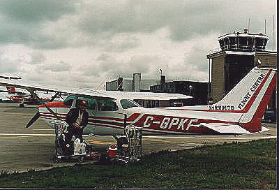
Lake Placid Airport On Monday Claude took us off and flew to Massena to clear customs and refuel. He then took us on to Lake Placid, landing at the airport there. Our club is called the Tri-County Flying Association. There was another group that leased space from us, as well as our club Cessna 172. Their name was the Yarmouth Flight Centre, a flying school. We had to rent the plane back from them for our flight. In the background of the picture can be seen White Face Mountain again, a different view.
Bangor Airport I took off from Lake Placid and flew back over our outgoing track. We were not landing at Bangor but were close enough to get a picture of it from the air. Our next landing was at Norridge Wock, Maine, for fuel. We intended to go from there to Eastport to have dinner at a restaurant that Claude thought was great. The forecast for fog was poor so we decided to head for home with a stop at St. Stephen to clear customs. As we started across the Bay of Fundy we had to go high because of the fog. Yarmouth reported that it was closed in. We headed for Digby and then got the same report. Claude then decide to head for Moncton, NB where he could call his parent's home in Amherst, NS, and get a ride home where we could stay the night.
Moncton, NB We finally got to Amherst, had a nice meal and then off to bed. The next day was poor and we were told that it would be mid afternoon before we would be able to carry on. In the picture Claude is stowing our gear. Our flight plan was to go to Amherst and fly over Claude's parents home and then down the Bay of Fundy. My turn and off we went. As we got over the Bay we suddenly hit fog again. I back tracked back over the land and we then headed for the coast with the intent of following the highway to Yarmouth. The cloud base was low and I had to stay at 800' ASL (Above Sea Level). Claude was in contact with Greenwood Air Force Base and as we approached between the base and the Bay we were warned that an Aurora and two other large aircraft were on a flight line from the Bay to the base and that we would be crossing in their path. I headed for the coast where there are 900' hills and then followed the hills.
By the time we got to Digby, Yarmouth warned that
fog was creeping over the town. When we got to the Yarmouth area it was
completely under the fog. I followed the highway that ended a block away
from the airport and looking out the left window suddenly saw the runway
staring at me. I got into the circuit in clear air and we made our landing.
It was a beautiful trip for me. I flew ten point three hours and I think
Claude did eight. It would have been more even but I landed at Bangor instead
of Eastport on our first leg.